
Any day with a new full disk
image of Earth is a good day. And folks, today is one of those days. The
National Oceanic and Atmospheric Administration (NOAA) launched the GOES-17
satellite in March. It’s a next generation weather satellite that will provide
a major upgrade over what NOAA is currently operating with over the eastern
U.S. and South America.
And while there have been
some issues with its cooling system that have made the parts of its vision blurry
due to the overheating at certain parts of its workday, some sensors on its
Advanced Baseline Imager are humming along just fine thank you very much. NOAA
released the first-ever images and videos using the imager and they are, well,
just look:
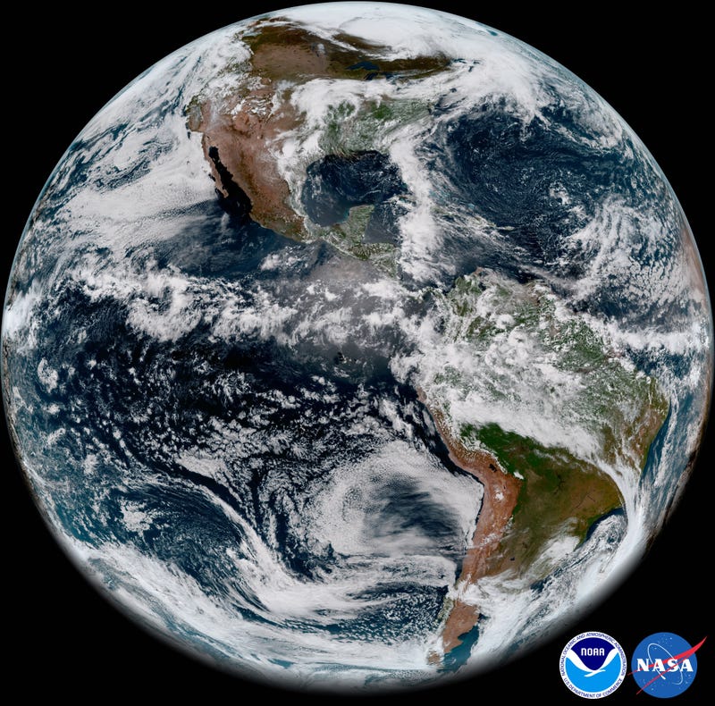
The image you see is from the May 20. It was made using sensors that capture blue, red, near-infrared, and
infrared channels of light. Nothing particularly special happened that day
weather-wise, but our planet is a stunner even on an average day.
The intertropical
convergence zone, a band of clouds that rings Earth near the equator, is
clearly visible cutting across northern Brazil and the Pacific Ocean. Marine
layer clouds are plowing into the West Coast of the U.S. and Baja California, a
fixture of late spring and early summer weather there. The deserts in the
Southwest and Chile are largely cloud-free as they are most days.
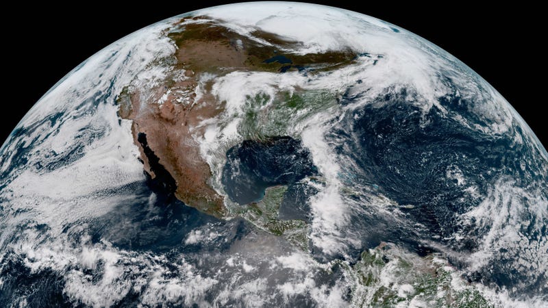
Along with the full disk
image, NOAA released a few zoomed in views to show off the incredible details GOES-17
can capture. Two are closeups of clouds off Chile and California.
A third video captures smoke
plumes from wildfires in Saskatchewan, showing that even small phenomenon on
the ground are still visible from a distant perch in space.
The satellite isn’t yet
operational. Once the kinks get worked out, the data and imagery it sends back
will be used to help improve forecasts for everything from hurricanes to
wildfires. But in the meantime, we get to enjoy some pretty amazing footage of
our pretty amazing planet.
Source
Source